TLTB will always work in the interest of the landowners
June 22, 2020
The Forester Jan – Aug | 2020
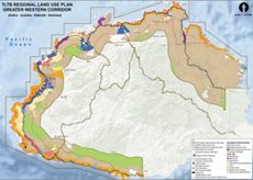
August 20, 2020The Greater West Landuse Master Plan boundary stretches from Galoa in Serua to Korovou in Tailevu along the corridor of the Kings Road and Queens Road; from the high water mark to the road and 10km inland from these highways for the purpose of strategically allocating and apportioning land uses for development, conservation and other land use types.
THE Greater West Landuse Master Plan (GWLMP) has finally been approved by the Department of Town & Country Planning (DTCP) for use in the high-potential areas between Serua and Tailevu North.
This is regional land use plan for the West which aims to assist in directing key investment decisions for developers as well as decision-making authorities at what is now known to be “a hotspot for development”.
The Greater West Landuse Master Plan boundary stretches from Galoa in Serua to Korovou in Tailevu along the corridor of the Kings Road and Queens Road; from the high water mark to the road and 10km inland from these highways for the purpose of strategically allocating and apportioning land uses for development, conservation and other land use types.
The GWLMP will also be useful for the identification of growth centres for future planning and releasing of land by TLTB for leasing.
The planning process commenced in 2018 and the Plan was submitted for endorsement to Director Town & Country PLanning in October 2019.
The DTCP, the key development approving authority in Fiji, had closely worked with TLTB in the entire planning process and the production of this Plan. As a result, this Plan becomes a synergized and integrated plan for TLTB, DTCP, and other key agencies in consultation with relevant stakeholders from government ministries, private institutions and NGO’s that had been a part of this project.
The GWLMP is important to guide TLTB in ensuring that more land is available and most importantly to guide our officers in the type of development and land to be released for leases that will create sustainable land use practices.
In effect, this will also create LOU empowerment and enable them to make decision on the types of leases to be issued on their land as well as feeding the TLTB platform for on-going lease application process.
Generally, the purpose of the Plan is to:
- Provide an inclusive and integrated blueprint that envisions the best and most appropriate future land use proposal for development within the Western Corridor over the next twenty years.
- Provide the general public, investors, and including the land-owning units (LOU) with information on future land use needed to make investment decisions.
- Help contribute in achieving the principles of smart growth, sound planning, and wise resource management.
- Incorporate the goals and policies related to land management and development that are provided in the national documents such as National Development Plan for Fiji, the Green Growth Framework, the Urban Policy Action Plan, the Urban Growth Management Action Plan, the National Housing Policy, etc.
- Identify issues prevalent within the western corridor hindering sustainable planning along the coastal regions (many of which are within iTaukei demarcated lands) and coordinate efforts (integration, coordination and collaboration) to tackling/managing them.
- Support the overall National Government Vision of “A Better Fiji for All” in view of the NDP 2015 -2035.
- Ensure sustainability, longevity and livability of iTaukei lands and that the interest of the landowners, communities and individuals are well taken care of in the long term.


